
Opportunities
Student helpers or a Research Assistant for scene image classification
This position aims to develop deep-learning-based algorithms to classify satellite images into two categories: those containing and those not containing thaw slumps (Figure 1). Thaw slumps are features in cold regions resulting from ground ice melting and have significant impacts on the local environment, global ecosystem, and carbon feedback. However, their spatial distribution and evolution across the entire cold regions remain unknown, contributing to uncertainties in future climate projections and posing risks to sustainable human society development. We have collected over 100 million images (similar to those in Figure 1) and need to categorize them into these two groups but have limited training data available. Therefore, this position focuses on algorithm development and does not necessitate scientific knowledge of thaw slumps or remote sensing skills.
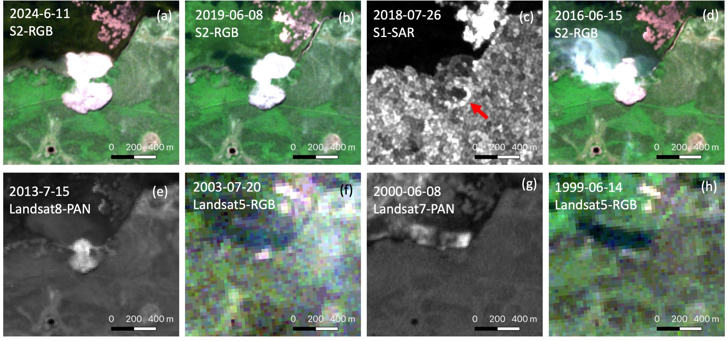 Figure 1: time-series satellite images of a thaw slump in the Canadian Arctic. The thaw slump first appeared in the 2003 image and gradually expanded and grew larger. Its features appear distinct in different color channels (RGB: a, b, & d), panchromatic (e & g), and Synthetic Aperture Radar (SAR) images (c). Notably, the thaw slump also exhibits slight variations in RGB images due to its expansion and the difference in spatial resolution between Sentinel-2 (10 m) and Landsat (30 m). During the image collection and preprocessing, we typically center the thaw slumps within the images. S1 and S2 refer to Sentinel-1 and Sentinel-2 satellites, respectively.
How to apply: If you’re interested in these positions, please contact Dr. Lingcao Huang and attach your CV to lingcaohuang@cuhk.edu.hk with the subject line: ‘Help14302324 + Your Name.’ We’ll provide a welcoming work environment and cutting-edge computing resources. If you are interested in this research, please don’t hesitate to get in touch with Dr. Lingcao Huang. We welcome any collaborations.